Area 14 and Area 17 in the 60's - 70's - 80's (map courtesy of Mary Ann Socrates-de Santis and Jess Socrates 2012)
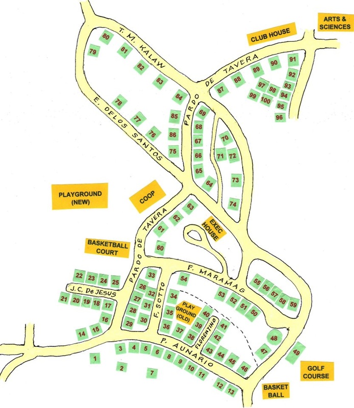
Map drawn by Mary Ann Socrates DeSantis in 1980's as per her memory of the old Area 14 and 17.
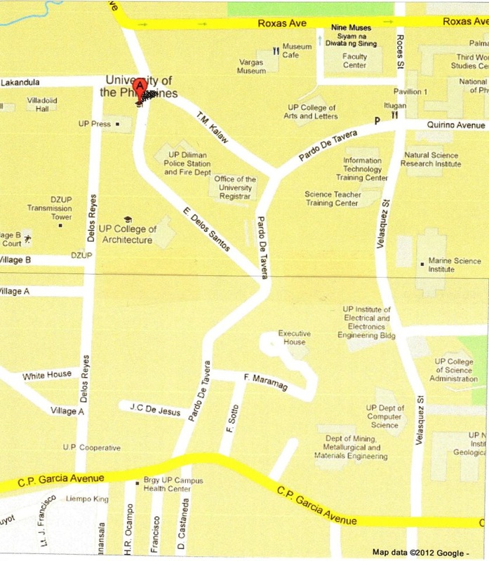
Jess Socrates google map 2012
I am sharing with everyone a MAP that I derived from google. It was hard for me to get a print-out of map that would include both Areas 14 and 17 on one page. I had to print two pages at same scale, paste them together and then scan the final map (I know this is low tech but that's as much as I can do technically).
Reason I did this is I intend to re-construct and update Mary’s map using a more accurate, properly proportioned road map. I will also incorporate information from Sara Miranda’s map.
Notice that this current map no longer includes the streets where Miranda’s and Nemenzo’s lived, part of Maramag and street in between Club House and Hidalgo’s. On my future reconstructed map, I will draw these in. Also, Aunario st. has been re-named C.P. Garcia Avenue.
I will then make small squares representing homes and just NUMBER them. It will be too tight to put the family names of residents in these squares. What I will do is just put the details on the numbered homes on separate text - like an appendix.
May I suggest this method also to the Area 2, etc residents?

Batang UP Campus 60-70-80's by Candy Lagmay Bandong is licensed under a Creative Commons Attribution-NonCommercial-NoDerivs 3.0 Unported License.
